Local surveyor networks are defined as either organised communities of surveying professionals or physical frameworks of reference points that underpin accurate measurement on site. Both types exist in the UK property and construction sector, and both affect the quality of any survey you commission. Understanding surveyor networks is not just academic. It directly shapes whether the professional you hire is competent, current, and capable of delivering results you can rely on. Surveymerchant connects property investors and individuals with qualified surveyors who are active in reputable professional networks and equipped with modern geodetic tools.
What are professional surveyor networks and how do they work?
Professional surveyor networks are structured communities where qualified surveyors share knowledge, build careers, and maintain standards. The most prominent example in the UK is RICS Matrics, the junior arm of the Royal Institution of Chartered Surveyors. RICS Matrics manages over 27 regional committees and hosts more than 200 events annually for career support and professional connections. That scale means a surveyor engaged with Matrics has regular access to training, mentoring, and peer review across the country.
These networks do more than organise social events. They deliver Continuing Professional Development, or CPD, which is the structured learning that keeps surveyors current on regulation, technology, and best practice. Surveyors active in network events and accredited training programmes are more likely to be well-informed on regional planning policies. For a property investor, that matters enormously. A surveyor who understands local planning constraints can flag issues that a less engaged professional might miss entirely.

How professional networks benefit you as a client
The practical benefits of professional networks flow directly to clients, not just to surveyors. When a surveyor participates actively in a professional network, they signal commitment to current standards and competence. Clients can identify reputable surveyors through this active participation, using it as a reliable quality signal before they even commission a survey.
- Network membership confirms the surveyor meets institutional standards.
- CPD participation keeps the surveyor updated on building regulations and planning law.
- Regional committee involvement builds local knowledge that generic directories cannot replicate.
- Peer accountability within networks reduces the risk of poor practice going unchallenged.
Pro Tip: Ask any surveyor you are considering to name the professional networks they belong to and when they last attended a network event or training session. A confident, specific answer is a strong indicator of genuine engagement.
For practical guidance on vetting surveyors effectively, checking network activity is one of the most reliable steps you can take before signing a contract.
What is a geodetic control network and why does it matter?
A geodetic control network is a framework of precisely known coordinates established on or near a project site. It serves as the fixed reference system from which all other measurements are taken. Without one, different survey teams working on the same site can produce conflicting results because they are each measuring from different starting points.
Construction projects require geodetic control networks that use least squares mathematical adjustments to distribute measurement errors and maintain coordination across teams. Least squares adjustment is a statistical method that finds the best fit across multiple measurements, reducing the cumulative effect of small errors. On a large development site, this process is the difference between walls that align and walls that do not.
GPS Control Networks provide a foundational precise reference for spatial data on complex, multi-phase, and large-scale projects. They ensure that survey data collected in march can be compared accurately with data collected in october, even if different instruments or teams were used. That consistency is critical for phased developments and long-term infrastructure projects.
Comparing geodetic network approaches
| Feature | Network RTK (CORS) | Traditional RTK | Single-base systems |
|---|---|---|---|
| Coverage area | Extensive, national | Limited to base range | Very limited |
| Base station required | No | Yes | Yes |
| Accuracy | Centimetre-level | Centimetre-level | Centimetre-level |
| Internet dependency | Yes | No | No |
| Cost per survey | Lower | Higher | Moderate |
| Scalability | High | Low | Low |
Maintenance of control networks is critical. Periodic verification prevents data decay and maintains network value over time. A control network that is not re-observed and updated can drift, producing errors that compound across a project.
Pro Tip: When commissioning a survey for a large or phased development, ask your surveyor which control network they are using and when it was last verified. An outdated control network is a hidden risk that can surface as costly rework later.
How does Network RTK technology improve survey accuracy?
Network RTK, or Real-Time Kinematic, is the technology that powers modern geodetic control networks. It works by using a dense grid of Continuously Operating Reference Stations, known as CORS, to generate virtual base stations anywhere within the network’s coverage area. The surveyor’s receiver connects to this virtual base and receives real-time corrections, producing centimetre-level accuracy without the surveyor needing to set up their own base station on site.
Network RTK surveying employs CORS networks with over 1,600 stations providing continuous centimetre-level accuracy across extensive areas. That density means coverage gaps are rare, and accuracy is consistent across urban and rural sites alike. The practical result is faster surveys, lower equipment costs, and fewer logistical complications on site.
Network RTK technology allows surveyors to work without local base stations, but it requires a stable internet connection to guarantee accuracy. In areas with poor mobile data coverage, accuracy can degrade. Property investors commissioning surveys in remote locations should confirm that their surveyor has a contingency plan for connectivity issues.
The numbered benefits for property survey projects are clear:
- Faster site setup because no base station installation is required.
- Lower cost per survey due to reduced equipment and labour.
- Consistent accuracy across large or irregularly shaped sites.
- Compatibility with multi-team projects through a shared reference framework.
- Reduced risk of measurement conflicts between survey phases.
For a deeper look at construction survey methods and how these technologies apply in practice, the type of project determines which approach delivers the best outcome.
How can property investors benefit from local surveyor networks?
Property investors who understand how local surveyors work gain a concrete advantage when selecting professionals and interpreting survey results. The first step is checking whether a surveyor holds active membership in a recognised professional network such as RICS Matrics. Membership alone is a baseline. Active participation, through events, committee roles, or CPD records, is the stronger signal.
Active surveyor network participation predicts greater knowledge of local policies and current best practices, affecting survey outcomes positively for clients. A surveyor who attends regional committee meetings in your area is far more likely to know about recent changes to local planning policy than one who operates in isolation. That knowledge directly affects the quality of advice you receive on a property purchase or development.
The practical benefits of connecting with local surveyors through professional networks include:
- Reduced survey errors because network-engaged surveyors apply current best practice.
- Faster transactions because a competent surveyor identifies issues early and clearly.
- Better advice on planning and regulatory constraints specific to your area.
- Greater accountability because network members answer to their peers and their institution.
- Cost savings from avoiding rework caused by inaccurate or incomplete surveys.
Pro Tip: Use platforms like Surveymerchant to filter surveyors by accreditation and network engagement rather than searching by price alone. The cheapest survey is rarely the best value when a missed defect costs tens of thousands of pounds.
For guidance on finding local surveyors who meet these standards, checking accreditation and network activity before you book is the single most effective step you can take.
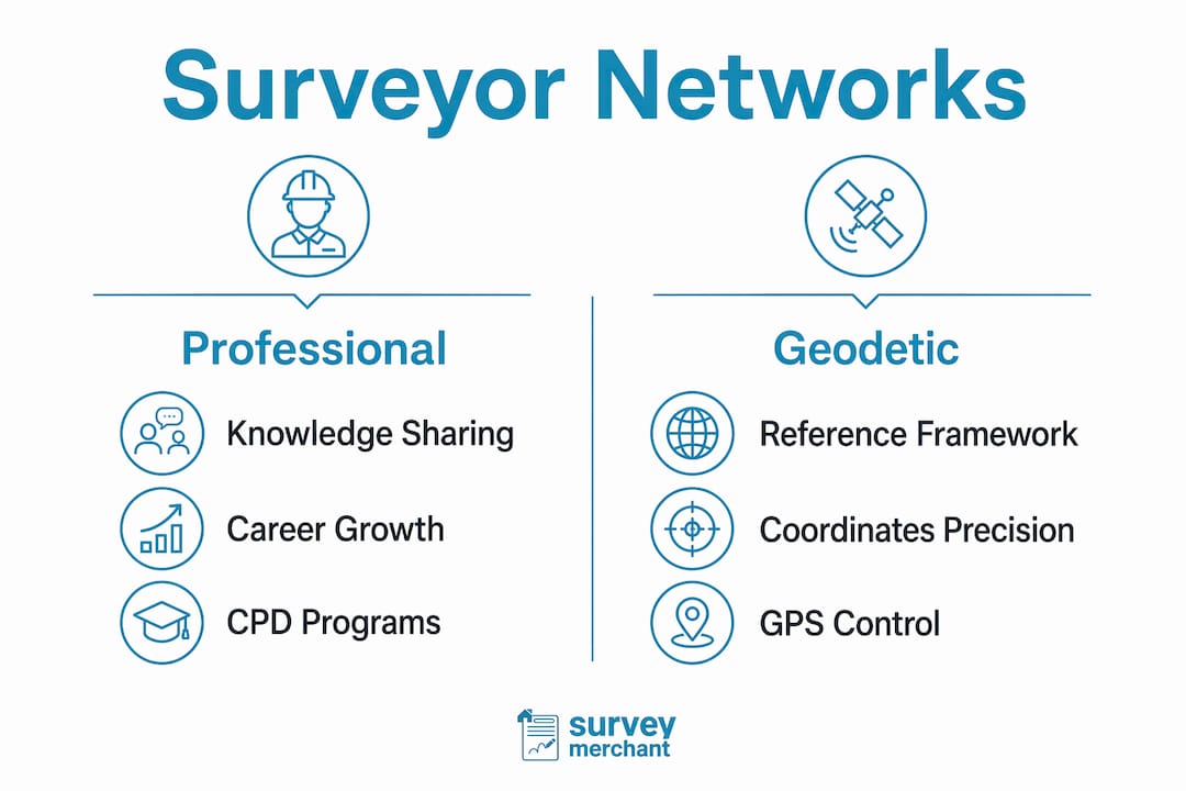
Professional networks vs geodetic networks: clearing up the confusion
Professional surveyor networks and geodetic control networks are entirely different things. The distinction between professional surveyor networks and geodetic control networks is often misunderstood by property investors and homeowners. One connects people. The other connects reference points.
A professional network like RICS Matrics is a community of individuals who share knowledge, attend events, and hold each other to professional standards. A geodetic control network is a physical system of fixed coordinates on or near a site that surveyors use as a reference framework for measurement. Both are called “networks,” but they serve completely different purposes.
The connection between the two is the surveyor. Surveyors hired through professional networks rely on geodetic control networks to ensure measurement precision on site. A professionally networked surveyor brings the right credentials and knowledge. A geodetically anchored survey brings the right measurements. You need both for a reliable outcome.
Pro Tip: When evaluating a surveyor’s credentials, ask two separate questions. First, which professional bodies or networks do they belong to? Second, which control network or reference system will they use on your site? The answers to both questions tell you whether you are hiring someone who is both professionally current and technically equipped.
Understanding surveyor networking practices also helps you ask better questions during the hiring process, which leads to better outcomes on your property project.
Key takeaways
Local surveyor networks fall into two distinct categories, and knowing which type applies to your situation determines whether you ask the right questions when hiring a surveyor.
| Point | Details |
|---|---|
| Two types of network | Professional networks connect surveyors to peers; geodetic networks connect measurements to fixed reference points. |
| Network engagement signals quality | Surveyors active in RICS Matrics or similar bodies are more likely to hold current knowledge of planning policy and best practice. |
| Geodetic accuracy is non-negotiable | Without a verified control network, multi-team or phased projects risk conflicting measurements and costly rework. |
| Network RTK reduces cost and time | CORS-based surveying removes the need for local base stations, cutting setup time and cost on most property projects. |
| Investors benefit from both | Checking professional membership and geodetic method together gives the clearest picture of surveyor competence. |
Why I think most property investors ask the wrong question
Most property investors ask “how much does a survey cost?” when they should be asking “how does this surveyor stay current?” I have seen expensive surveys deliver poor results because the professional had no meaningful connection to either a professional network or a modern geodetic reference system. The two are not interchangeable, but they are both necessary.
The technology side of this has shifted faster than most clients realise. Network RTK and CORS-based systems have made centimetre-level accuracy accessible on projects that would previously have required expensive base station setups. That is genuinely good news for investors. But it only benefits you if your surveyor is actually using these tools and understands their limitations, particularly around internet connectivity in rural or semi-rural sites.
The professional network side is equally underrated. A surveyor who sits on a regional RICS Matrics committee knows things about local planning policy, emerging case law, and regional market conditions that simply do not appear in any textbook. That knowledge is the difference between a survey that identifies a problem and one that contextualises it within the local regulatory environment. For a property investor making a six or seven-figure decision, that context is worth far more than a marginally lower survey fee.
My honest advice is to treat network engagement as a proxy for professional seriousness. It is not a guarantee, but it is the most reliable signal available before you commit. Career development platforms like PEAR also highlight how structured professional networking shapes long-term competence in technical fields, which applies directly to the surveying profession.
— N
Surveymerchant: connecting you with network-engaged surveyors
Surveymerchant works with qualified surveyors who are active in professional networks and equipped with current geodetic tools. Whether you need a building survey, a structural assessment, or a full commercial property inspection, the platform matches you with professionals whose credentials and network engagement are verified.

For property investors, that means fewer surprises, clearer reports, and surveyors who understand the local regulatory context of your asset. Surveymerchant’s commercial property surveys service connects you with accredited surveyors who bring both professional network knowledge and technical precision to every instruction. Request a survey through Surveymerchant and get a professional whose credentials you can verify before they set foot on site.
FAQ
What are local surveyor networks?
Local surveyor networks are either professional communities of qualified surveyors who share knowledge and maintain standards, or geodetic frameworks of fixed reference points used to anchor measurements on site. Both types directly affect the quality of any survey you commission.
How do I check if a surveyor is active in a professional network?
Ask the surveyor directly which professional bodies they belong to and when they last attended a network event or completed CPD. RICS Matrics membership and regional committee involvement are strong indicators of active engagement.
Why does a geodetic control network matter for my property project?
A geodetic control network provides the fixed reference system from which all measurements on a site are taken. Without one, different survey teams produce conflicting results, which leads to costly rework and project delays.
What is Network RTK and how does it improve survey accuracy?
Network RTK uses a dense grid of reference stations to generate real-time corrections for surveyors in the field, delivering centimetre-level accuracy without a local base station. It requires a stable internet connection to function at full precision.
How can understanding surveyor networks help me as a property investor?
Knowing how local surveyors work through professional and geodetic networks helps you ask better questions, select more competent professionals, and reduce the risk of survey errors that affect property transactions and development projects.