The most damaging common surveying mistakes are incorrect boundary identification, measurement and datum errors, poor instrument calibration, neglecting site conditions, misreading legal descriptions, unclear briefs, inadequate documentation, missing QA checks, undertrained personnel, and failure to cross-check records against existing data. For each: verify boundaries against historic deeds; record datum and units before leaving site; calibrate kit and check control before running detail; conduct a pre-survey reconnaissance; read the original conveyance, not just the title plan; agree scope in writing; log every field observation; build redundancy into every survey; confirm qualifications before mobilising; and compare outputs against previous surveys.
The ten mistakes at a glance:
- Incorrect boundary identification
- Measurement and topographic data errors
- Instrument, control and calibration failures
- Neglecting environmental and site conditions
- Errors in legal descriptions and title-plan interpretation
- Inadequate communication and unclear briefs
- Poor data recording and documentation
- Insufficient QA and redundancy checks
- Undertrained or unqualified survey personnel
- Failure to verify data against existing records
Table of Contents
- 1. Incorrect boundary identification is still the most disputed surveying error
- 2. Measurement and topographic data errors compound quickly
- 3. Instrument setup, control network and calibration failures cause systematic errors
- 4. Neglecting environmental and site conditions creates gaps and hazards
- 5. Errors in legal descriptions and title-plan interpretation lead to costly disputes
- 6. Unclear briefs and poor communication between teams generate rework
- 7. Poor data recording and documentation causes loss and misinterpretation
- 8. What preventive QA procedures should every UK survey include?
- 9. Undertrained personnel introduce procedural errors that are hard to detect
- 10. Failure to verify data against existing records compounds every other error
- UK standards, RICS classifications and legal risks if surveys are faulty
- Key takeaways
- The pattern behind the mistakes
- Get a standards-compliant survey through Surveymerchant
- Authoritative UK sources and further reading
1. Incorrect boundary identification is still the most disputed surveying error
Boundary mistakes sit at the root of more UK property disputes than almost any other surveying error. The reason is structural: title plans carry an explicit disclaimer that they show the general position of boundaries, not the exact line. Under the General Boundaries Rule (Land Registration Act 2002), a title plan provides prima facie indication only. At common OS mapping scales, the printed line width alone can represent a significant distance on the ground, making title plans wholly inadequate for resolving disputes over narrow encroachments.
Surveyors most often go wrong by treating the Land Registry plan as definitive, ignoring physical features that have existed for decades, and failing to trace the original conveyance or transfer deed. RICS boundary procedures are clear: when a title plan is ambiguous, historic conveyances and physical features must both be consulted and compared.
Prevention checklist:
- Obtain the full title register and read the notes, not just the plan
- Trace the original conveyance or transfer deed for metes-and-bounds descriptions
- Conduct a physical boundary walk and photograph every feature (walls, fences, hedges, ditches)
- Compare historic plans with current physical evidence and note discrepancies in writing
- Record all assumptions about boundary intent in the brief before starting work
Pro Tip: When dimensions matter for construction or a dispute is already brewing, instruct a boundary dispute expert witness rather than relying on a standard measured survey. Document the agreed scope and any title-plan limitations in the brief so assumptions are on record from day one.
2. Measurement and topographic data errors compound quickly
A single transposed figure in a field notebook can shift an entire site model by metres. The most frequent measurement errors are misreading staff or scale, recording the wrong units, applying an incorrect datum or coordinate reference system (CRS), and failing to take redundant observations that would catch the mistake before leaving site.
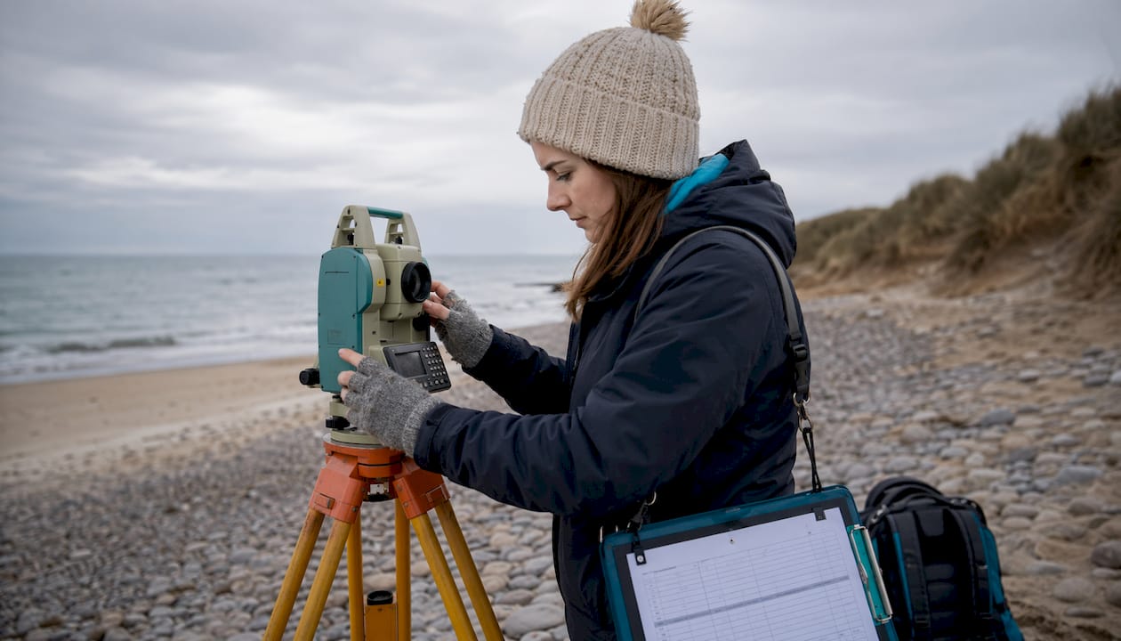
The RICS measured surveys standard requires surveyors to eliminate systematic and gross errors and to build sufficient redundancy into observations so that random errors can be quantified. Without redundant observations, survey accuracy simply cannot be verified.
Step-by-step field and post-processing workflow:
- Confirm datum and CRS with the client before mobilising; record both in the field book header
- Set up GNSS and total station, and verify against a known control point before recording any detail
- Take redundant observations on all control points; compute control before running detail
- Cross-check heights using trigonometric, GNSS and levelling data where possible
- Check field notes for unit consistency (metres vs feet, OS grid vs local grid) before leaving site
- On return to the office, run a tolerance check on all control residuals before processing detail
- Apply version control to all processed files; record the CRS and datum in file metadata
Pro Tip: Before packing up, re-observe two or three control points and compare the results against your earlier readings. A discrepancy larger than your specified tolerance is a clear signal of a systematic error — far cheaper to find on site than in the office the following week.
3. Instrument setup, control network and calibration failures cause systematic errors
Poor control is the gift that keeps on giving — in the worst possible way. An unchecked calibration error or a badly spaced control network introduces a systematic bias that propagates through every detail observation. By the time the error surfaces in the office, re-surveying the entire site may be the only fix.

RICS guidance recommends establishing control in a hierarchy from primary to secondary to tertiary, working from the whole to the part, and confirming that control accuracy requirements have been met before processing any detail. See also the construction survey types guide for a practical overview of how control requirements vary by survey type.
Equipment and control checklist:
- Check instrument bubble and optical plummet before each setup
- Follow the manufacturer’s calibration schedule; record calibration dates in the equipment log
- Use a minimum of three well-spaced control points; add secondary points to increase density for large sites
- Run a closed traverse or network adjustment and check residuals against the accuracy specification
- Tie all new control into existing control or a national grid reference before running detail
- Compute and verify control before starting detail observations; never run detail on unverified control
- If residuals exceed tolerance, stop, investigate, and re-observe before proceeding
For common measurement tool checks that apply across field instruments, a practical contractor-focused reference covers the basics of pre-use verification routines.
4. Neglecting environmental and site conditions creates gaps and hazards
Overgrown vegetation hides features. Seasonal soft ground swallows pegs. Restricted access forces workarounds that leave survey gaps. These are not edge cases; they are routine on UK sites, and failing to account for them in advance is one of the top surveying blunders that leads to incomplete deliverables and, occasionally, serious safety incidents.
The duty to identify detectable environmental hazards is not merely good practice. In Darcliffe v Glanville [2024], the court confirmed that a competent consultant must flag foreseeable environmental risks that are apparent on site, even when the client has not specifically asked for them.
Pre-survey reconnaissance checklist:
- Walk the site before mobilising survey teams; photograph access constraints and vegetation
- Check for overhead and underground services with the relevant utility providers
- Confirm access permissions in writing, including any locked gates or restricted zones
- Review known contamination records and check for protected species designations
- Note seasonal conditions (flooding, soft ground, leaf cover) and plan survey timing accordingly
- Record all constraints in the brief and agree with the client how gaps will be handled
- Ensure health and safety compliance obligations are recorded and signed off before mobilising
Timing a survey to avoid peak vegetation cover or standing water is not a luxury; it is a quality decision that directly affects the completeness of the deliverable.
5. Errors in legal descriptions and title-plan interpretation lead to costly disputes
Reading a title plan without tracing the underlying conveyance is like reading a map without a scale bar. The Land Registration Act 2002 makes clear that title plans are based on OS mapping and provide a prima facie indication only. At typical scales, the width of a printed line can represent a meaningful distance on the ground, which is why disputes over narrow encroachments cannot be resolved from the plan alone.
Verification sequence:
- Read the title register notes in full; flag any restrictions, covenants or easements
- Locate the original conveyance or transfer deed and extract any metes-and-bounds descriptions
- Compare historic plans with current physical evidence and note any inconsistencies
- Where dimensions matter for construction, commission a determined boundary survey
- Flag prescription, possessory title or adverse possession indicators to the instructing solicitor immediately
Pro Tip: Include a short clause in every brief that records the surveyor’s assumptions about title plan accuracy and states explicitly that the survey does not constitute a legal boundary determination unless instructed as such. This one sentence has prevented more disputes than any amount of post-survey correspondence.
6. Unclear briefs and poor communication between teams generate rework
A brief that does not specify accuracy, datum, deliverable format or site extents is not a brief; it is an invitation to rework. The most common communication failures are missing deliverable definitions, no agreed coordinate system, unstated accuracy tolerances, and absent assumptions about what is and is not in scope.
Brief template: minimum required clauses
- Scope of works: exact site extents, features to be surveyed, and features explicitly excluded
- Accuracy and specification tolerance: plan accuracy at the required scale, height accuracy in millimetres
- Datum and coordinate system: OS National Grid or local grid, Ordnance Datum Newlyn or site datum
- Access constraints: known restrictions, permissions required, and who is responsible for obtaining them
- Deliverable formats and deadlines: file types (DWG, DXF, PDF, point cloud), coordinate metadata, submission date
- Assumption clauses: what the surveyor will assume about title plan accuracy, access, and existing records
- Sign-off procedure: who approves the brief, how changes are logged, and who authorises scope variations
Handover between field and office teams deserves the same rigour. A verbal handover that omits the datum or the agreed CRS is a data-entry error waiting to happen. Log it in writing every time.
7. Poor data recording and documentation causes loss and misinterpretation
Field notes that cannot be read back in the office, files saved without version control, and observations recorded without metadata are among the most avoidable surveying errors. Once data is lost or ambiguous, the only remedy is a return visit, which costs time and credibility.
Good documentation practice is straightforward: use a consistent file-naming convention that includes the project reference, date and version number; record the CRS and datum in every file’s metadata; keep a field book or digital equivalent that logs instrument serial numbers, calibration dates, weather conditions and any anomalies observed on site. Back up raw data before processing begins, and never overwrite the original.
A discrepancy log, maintained throughout the project, captures every instance where field observations do not match existing records. That log becomes the audit trail if a dispute arises later. Pair it with a peer-review step before any deliverable leaves the office, and most common report writing mistakes surveyors make, such as missing annotations, incorrect scale bars and unlabelled datums, are caught before they reach the client.
8. What preventive QA procedures should every UK survey include?
Quality assurance is not a final check; it is a continuous process built into the survey from the moment the brief is agreed. The RICS measured surveys standard requires redundancy in observations so that random errors can be quantified and systematic or gross errors detected before they reach the deliverable.
Mandatory QA steps:
- Take redundant observations on all control; compute and verify control before running detail
- Run an independent verification check on at least 10% of detail observations
- Perform a control adjustment and confirm residuals are within the accuracy specification
- Maintain a discrepancy log throughout processing; resolve every flagged item before delivery
- Conduct a peer review of all deliverables before submission; check scale bars, datum labels and annotation
- Archive raw field data, processing files and the final deliverable with version numbers and dates
Beyond the technical steps, CPD keeps teams sharp. A brief in-house audit once or twice a year, reviewing a sample of recent projects against the brief and the deliverable, surfaces procedural drift before it becomes a liability. For practical measurement error checks that translate well to field QA routines, contractor-focused resources offer a useful cross-discipline perspective.
9. Undertrained personnel introduce procedural errors that are hard to detect
An assistant surveyor who does not understand why redundant observations matter will skip them under time pressure. A site manager who does not know the difference between OS National Grid and a local site grid will record the wrong datum. These are not hypothetical scenarios; they are recurring root causes of survey accuracy issues on UK projects.
Qualifications matter, but so does supervision. RICS membership signals that a surveyor has met a defined competency standard, but it does not guarantee that every team member on site has the same level of understanding. Before mobilising, confirm that the lead surveyor holds the appropriate RICS qualification for the survey type, that assistants have been briefed on the specific procedures for this project, and that there is a clear escalation path if something unexpected arises on site.
Training records and CPD logs should be retained as part of the project file. If a negligence claim arises later, demonstrating that the team was appropriately qualified and supervised is a material part of the defence.
10. Failure to verify data against existing records compounds every other error
Treating a new survey as if no previous data exists is a mistake that compounds every other error on this list. Existing records, whether a previous topographic survey, an as-built drawing, or a utility record, provide an independent check on new observations. Where the two sets of data diverge significantly, that divergence is a signal worth investigating before the deliverable is issued.
Cross-checking against existing records also catches datum mismatches that would otherwise go unnoticed. A site surveyed to a local datum in 2018 and re-surveyed to OS National Grid in 2026 will appear to have shifted unless the transformation is applied correctly and documented. Verify the coordinate system of all existing records before comparing them with new data, and record the comparison in the project file.
UK standards, RICS classifications and legal risks if surveys are faulty
RICS classifies surveying errors as systematic (bias), gross (blunders) and random (statistical noise). The professional obligation is unambiguous: surveyors must eliminate all detectable systematic and gross errors through calibration, redundancy and self-checking methodologies. Random errors, which cannot be eliminated, must be quantified through sufficient redundancy so that their magnitude is known and reported.
Legal liability follows from professional failure. Common negligence triggers include failing to inspect accessible areas, missing observable defects, errors in valuation methodology, and overlooking planning or legal restrictions. The PNC Legal guidance on surveyor negligence adds failing to survey the correct property or segment of land, and failing to use the most appropriate valuation methodology, as further grounds for claims.
Two recent cases sharpen the picture. In Darcliffe v Glanville [2024], the court confirmed that a competent surveyor must identify detectable environmental hazards in foreseeable risk areas, even without an explicit instruction to do so. In Eiger Funding v Ridge and Partners [2026], the court found that a monitoring surveyor acting for multiple parties without written informed consent from each party materially raised their negligence exposure. The RICS guidance for independent monitoring surveyors requires written informed consent where dual roles exist; Ridge did not obtain it, and the conflict of interest compounded the substantive failures in their reporting.
If an error is discovered after delivery: notify the client immediately in writing, preserve all field data and processing files, do not overwrite or amend any records, and seek legal advice or instruct an expert witness before making any admissions. For a full account of how surveyor negligence claims typically unfold in the UK, the Surveymerchant guide covers the practical steps in detail.
Key takeaways
Avoiding the most damaging surveying errors requires verified boundaries, calibrated instruments, redundant observations, a written brief, and a peer-reviewed deliverable on every project.
| Point | Details |
|---|---|
| Boundary verification | Always trace the original conveyance; never rely on a title plan alone to resolve a boundary dispute. |
| Redundancy and calibration | RICS requires elimination of systematic and gross errors; build redundant observations into every control network. |
| Written brief | Record datum, CRS, accuracy tolerance, deliverable format and all assumptions in writing before mobilising. |
| Legal exposure | Negligence claims arise from failure to inspect, missing observable defects, and acting for multiple parties without written informed consent. |
| Surveymerchant | Surveymerchant connects clients with RICS-qualified surveyors for building surveys, boundary disputes, expert witness appointments and more across the UK. |
The pattern behind the mistakes
The ten mistakes above are not random. They cluster around three root causes: time pressure that skips verification steps, briefs that leave too much to assumption, and an over-reliance on title plans that were never designed to carry the weight placed on them.
The title plan problem is worth dwelling on. Practitioners know the General Boundaries Rule intellectually, yet in practice, title plans are still treated as definitive far more often than they should be. Part of the reason is client expectation: a client who has paid for a Land Registry search expects the plan to answer their question. The surveyor’s job is to explain, clearly and in writing, what the plan can and cannot tell them, and to recommend a forensic survey when the stakes justify it.
Time pressure is harder to fix structurally, but a pre-mobilisation checklist that takes ten minutes to complete catches the majority of setup errors before they become expensive. The surveys that go wrong are rarely the ones where something genuinely unforeseeable happened. They are the ones where a known check was skipped because the team was already running late.
Surveymerchant’s panel of RICS-qualified surveyors is built around exactly these standards: verified qualifications, clear scope agreements, and deliverables that are peer-reviewed before they leave the office.
Get a standards-compliant survey through Surveymerchant
Knowing what can go wrong is only half the answer. The other half is instructing a surveyor who has the qualifications, the procedures and the professional indemnity cover to get it right.

When requesting a quote, ask for: RICS membership number and grade; the accuracy specification and datum they will use; sample deliverables from a comparable project; their professional indemnity insurance limit; and a written brief that records all assumptions before work begins. Surveymerchant matches you with RICS-qualified surveyors across the UK for building surveys, boundary disputes, party wall matters, structural assessments and commercial property surveys. Every surveyor on the panel is vetted for qualifications and experience before they receive a referral. To find a qualified surveyor for your project, visit Surveymerchant’s building surveying services and request a quote today.
Authoritative UK sources and further reading
- RICS Measured Surveys of Land, Buildings and Utilities (3rd edition) — the definitive standard for error classification, redundancy requirements and control hierarchy in UK measured surveys
- RICS Boundaries: Procedures for Boundary Identification, Demarcation and Dispute Resolution (2022) — covers the recommended verification sequence when title plans are ambiguous
- HM Land Registry: how accurate are title plans? (Lease Planners) — explains the General Boundaries Rule and the practical limits of OS-based title plans
- TSABI Law: are Land Registry plans accurate enough to resolve a boundary disagreement? — legal analysis of map tolerances and when forensic survey evidence is required
- Eiger Funding v Ridge and Partners (Mondaq) — case summary on monitoring surveyor duties, conflict of interest and informed consent
- Surveyor negligence: when property valuations go wrong (Carlsons Solicitors) — practical overview of common negligence triggers and the competency standard applied by courts
- Surveymerchant: surveyor negligence claims guide — UK homeowner and practitioner guide to negligence scenarios and practical next steps
- Surveymerchant: boundary dispute expert witness services — for projects where a CPR 35-compliant expert witness appointment is required
- Won2Build: construction measurement tools for contractors — practical field tool checks and take-off routines applicable to survey teams
This article provides general information about surveying practice and UK professional standards. It is not legal or professional advice. For your specific situation, consult a RICS-qualified surveyor or a qualified solicitor.
Recommended
Related guides
Book a RICS surveyor
Survey Merchant provides vetted RICS surveyors across 100+ UK locations at fixed fees:
→ Level 2 Home Survey (HomeBuyer Report)
→ Level 3 Building Survey (full structural survey)
→ RICS Red Book property valuations
→ Party wall surveyors — notices, awards & schedules of condition
→ Expert witness surveyors — CPR Part 35 reports for property disputes